File:Liquidambar-styraciflua-ripen-fruit.jpg: Difference between revisions
Jump to navigation
Jump to search
== Summary == Created using map found on Wikiedia at United States showing all counties. Map was created using US Foresty Service map as model. == Licensing == {{GFDL}} http://en.wikipedia.org/wiki/Image:Liquid_Amber_Range.png |
(No difference)
|
Latest revision as of 10:26, 14 August 2007
Summary
Created using map found on Wikiedia at United States showing all counties. Map was created using US Foresty Service map as model.
Licensing

Permission is granted to copy, distribute and/or modify this document under the terms of the GNU Free Documentation License, Version 1.2 or any later version published by the Free Software Foundation; with no Invariant Sections, no Front-Cover Texts, and no Back-Cover Texts.
Subject to disclaimers.
File history
Click on a date/time to view the file as it appeared at that time.
| Date/Time | Thumbnail | Dimensions | User | Comment | |
|---|---|---|---|---|---|
| current | 10:31, 14 August 2007 | 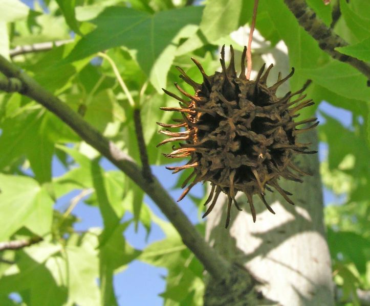 | 723 × 599 (64 KB) | MediaWiki default (talk | contribs) | '''Liquidambar styraciflua''' ('''Hamamelidaceae''', '''Magnoliophyta'''). {{es|Infrutescencia del año pasado.}} {{en|A year old infrutescence.}} * '''Source''' Luis Fernández García L. Fdez. / 2005-06-04 / Parq |
| 10:26, 14 August 2007 |  | 800 × 595 (63 KB) | MediaWiki default (talk | contribs) | == Summary == Created using map found on Wikiedia at United States showing all counties. Map was created using US Foresty Service map as model. == Licensing == {{GFDL}} http://en.wikipedia.org/wiki/Image:Liquid_Amber_Range.png |
You cannot overwrite this file.
File usage
The following file is a duplicate of this file (more details):
The following page uses this file: